So pls pm me all your details and I will add to the group and watsup group.
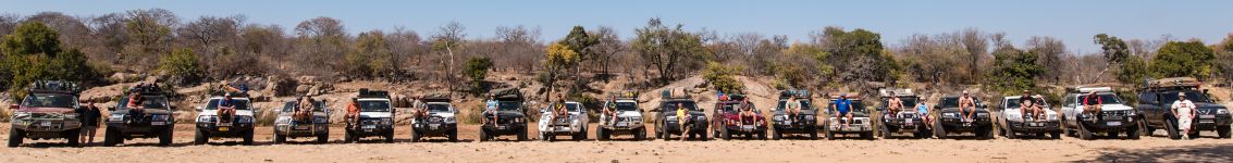
Trip 4 River trip 5-9 August 2016
-
offroadbiker

- Moderator
- Posts: 2863
- Joined: 25 Jul 2012 08:36
- Full Name: Dirk de Clerk
- Nickname: ORB
- Home Town: Krugersdorp
- Current 4x4: Patrol GQ 4.2 ST
- Home Language: Afrikaans/English
- Location: Krugersdorp
- Has thanked: 192 times
- Been thanked: 274 times
Re: Trip 4 River trip 5-9 August 2016
It seems these crazy Patrol guys philosophy = the more the merrier 
So pls pm me all your details and I will add to the group and watsup group.
So pls pm me all your details and I will add to the group and watsup group.
Dirk
1996 Nissan Patrol 4.2 ST
1996 Nissan Patrol 4.2 ST

-
offroadbiker
- Moderator
- Posts: 2863
- Joined: 25 Jul 2012 08:36
- Full Name: Dirk de Clerk
- Nickname: ORB
- Home Town: Krugersdorp
- Current 4x4: Patrol GQ 4.2 ST
- Home Language: Afrikaans/English
- Location: Krugersdorp
- Has thanked: 192 times
- Been thanked: 274 times
-
SJC

- Patrolman 1000+

- Posts: 3351
- Joined: 23 Nov 2014 14:20
- Full Name: Fanus
- Nickname: Fanus
- Home Town: Nelspruit
- Current 4x4: 1996 Patrol 4.2 GQ (TB42)
- Home Language: Afrikaans/English
- Has thanked: 243 times
- Been thanked: 208 times
- Contact:
Re: Trip 4 River trip 5-9 August 2016
Possible river entry points:
-23.344678, 30.728793
-23.365639, 30.753512
(Dirk dis hoe ek verstaan, help as ek verkeerd is).
-23.344678, 30.728793
-23.365639, 30.753512
(Dirk dis hoe ek verstaan, help as ek verkeerd is).
- Attachments
-
- river entry.jpg (145.67 KiB) Viewed 3273 times
1996 Nissan Patrol 4.2 SGL
-
offroadbiker
- Moderator
- Posts: 2863
- Joined: 25 Jul 2012 08:36
- Full Name: Dirk de Clerk
- Nickname: ORB
- Home Town: Krugersdorp
- Current 4x4: Patrol GQ 4.2 ST
- Home Language: Afrikaans/English
- Location: Krugersdorp
- Has thanked: 192 times
- Been thanked: 274 times
Re: Trip 4 River trip 5-9 August 2016
@ opsies om in te gaan
Ek weet ek het laasjaar by boonste een uitgegaan wat regoor settle ment uitkom.
Ek weet ek het laasjaar by boonste een uitgegaan wat regoor settle ment uitkom.
- Attachments
-
- river%20entry.jpg (137.7 KiB) Viewed 3272 times
Dirk
1996 Nissan Patrol 4.2 ST
1996 Nissan Patrol 4.2 ST
-
SJC
- Patrolman 1000+
- Posts: 3351
- Joined: 23 Nov 2014 14:20
- Full Name: Fanus
- Nickname: Fanus
- Home Town: Nelspruit
- Current 4x4: 1996 Patrol 4.2 GQ (TB42)
- Home Language: Afrikaans/English
- Has thanked: 243 times
- Been thanked: 208 times
- Contact:
Re: Trip 4 River trip 5-9 August 2016
En dan sal ons seker binne hierdie rooi kol kampplek soek vir eerste aand?
- Attachments
-
- kamp.jpg (180.08 KiB) Viewed 3270 times
1996 Nissan Patrol 4.2 SGL
-
offroadbiker
- Moderator
- Posts: 2863
- Joined: 25 Jul 2012 08:36
- Full Name: Dirk de Clerk
- Nickname: ORB
- Home Town: Krugersdorp
- Current 4x4: Patrol GQ 4.2 ST
- Home Language: Afrikaans/English
- Location: Krugersdorp
- Has thanked: 192 times
- Been thanked: 274 times
Re: Trip 4 River trip 5-9 August 2016
Yep, sodat ouens soos ek Saterdag oggend julle kan join...........
Dirk
1996 Nissan Patrol 4.2 ST
1996 Nissan Patrol 4.2 ST
-
SJC
- Patrolman 1000+
- Posts: 3351
- Joined: 23 Nov 2014 14:20
- Full Name: Fanus
- Nickname: Fanus
- Home Town: Nelspruit
- Current 4x4: 1996 Patrol 4.2 GQ (TB42)
- Home Language: Afrikaans/English
- Has thanked: 243 times
- Been thanked: 208 times
- Contact:
Re: Trip 4 River trip 5-9 August 2016
Is daar moontlikheid om ys op roete te koop, bv by Sekhiming of Dzumeri ? Of net by Die Eiland?
1996 Nissan Patrol 4.2 SGL
-
SJC
- Patrolman 1000+
- Posts: 3351
- Joined: 23 Nov 2014 14:20
- Full Name: Fanus
- Nickname: Fanus
- Home Town: Nelspruit
- Current 4x4: 1996 Patrol 4.2 GQ (TB42)
- Home Language: Afrikaans/English
- Has thanked: 243 times
- Been thanked: 208 times
- Contact:
Re: Trip 4 River trip 5-9 August 2016
Some google maps screen shots with coordinates....
(Dirk help maar as ek errens fout gemaak het of iets uit gelaat het.)
Klein Letaba River Entry:
DD -23.366102 30.753771
DMS S 23° 21' 57.967'' E 30° 45' 13.575''
Possible camping spot for first night:
DD -23.373385 30.780122
DMS S 23° 22' 24.186'' E 30° 46' 48.439''
Possible camping spot next to KNP fence, night2:
DD -23.48974 31.057779
DMS S 23° 29' 23.064'' E 31° 3' 28.004''
Klein Letaba exit/bridge:
DD -23.487331 31.014663
DMS S 23° 29' 14.392'' E 31° 0' 52.786''
From klein letaba exit/bridge to Die Eiland - last year some people refueled at Die Eiland:
Die Eiland to Molototsi Entry point:
Molototsi Entry point:
DD -23.677816 30.922168
DMS S 23° 40' 40.138'' E 30° 55' 19.804''
Dzumeri - Phalaborwa-giyani road:
DD -23.572559 30.710784
DMS S 23° 34' 21.212'' E 30° 42' 38.822''
Sekhiming Bridge:
DD -23.438258 30.548007
DMS S 23° 26' 17.729'' E 30° 32' 52.825''
Molototsi Exit - cant remeber from last year if we entered here, but think so:
DD -23.514502 30.419578
DMS S 23° 30' 52.207'' E 30° 25' 10.48''
(Dirk help maar as ek errens fout gemaak het of iets uit gelaat het.)
Klein Letaba River Entry:
DD -23.366102 30.753771
DMS S 23° 21' 57.967'' E 30° 45' 13.575''
- klein letaba river entry.jpg (379.2 KiB) Viewed 3201 times
DD -23.373385 30.780122
DMS S 23° 22' 24.186'' E 30° 46' 48.439''
- possible camping spot night1.jpg (519.41 KiB) Viewed 3201 times
DD -23.48974 31.057779
DMS S 23° 29' 23.064'' E 31° 3' 28.004''
- camp knp fence.jpg (413.53 KiB) Viewed 3201 times
DD -23.487331 31.014663
DMS S 23° 29' 14.392'' E 31° 0' 52.786''
- klein letaba exit bridge.jpg (441.19 KiB) Viewed 3201 times
- klein letaba exit to die eiland.jpg (142.17 KiB) Viewed 3201 times
- Die Eiland to molototsi entry.jpg (94.86 KiB) Viewed 3201 times
DD -23.677816 30.922168
DMS S 23° 40' 40.138'' E 30° 55' 19.804''
- molototsi entry.jpg (652.01 KiB) Viewed 3201 times
DD -23.572559 30.710784
DMS S 23° 34' 21.212'' E 30° 42' 38.822''
- dzumeri phal-giyan rd.jpg (569.35 KiB) Viewed 3201 times
DD -23.438258 30.548007
DMS S 23° 26' 17.729'' E 30° 32' 52.825''
- sekhiming bridge.jpg (418.87 KiB) Viewed 3201 times
DD -23.514502 30.419578
DMS S 23° 30' 52.207'' E 30° 25' 10.48''
- molototsi exit.jpg (323.56 KiB) Viewed 3201 times
1996 Nissan Patrol 4.2 SGL
-
offroadbiker
- Moderator
- Posts: 2863
- Joined: 25 Jul 2012 08:36
- Full Name: Dirk de Clerk
- Nickname: ORB
- Home Town: Krugersdorp
- Current 4x4: Patrol GQ 4.2 ST
- Home Language: Afrikaans/English
- Location: Krugersdorp
- Has thanked: 192 times
- Been thanked: 274 times
Re: Trip 4 River trip 5-9 August 2016
Alles lyk so min of meer reg, ons het net nie nodig om naby Die Eiland te gaan nie. Hy is 60km van waar ons uit Klein Letaba klim en Giyani is ook 60km verskil is Giyani is teerpad en die Eiland is slegte grondpad. Dis nou as jy brandstof wil gooi.
As die ouens luister en vol maak by Giyani kan ek nie sien hoekom hulle nie Dzumiri sal haal nie.
Dis 5km teerpad, 50km rivier 30km teerpad 5km gronpad en dan 40km rivier. Nie eers 'n Patrol is so swaar op brandstof nie
As die ouens luister en vol maak by Giyani kan ek nie sien hoekom hulle nie Dzumiri sal haal nie.
Dis 5km teerpad, 50km rivier 30km teerpad 5km gronpad en dan 40km rivier. Nie eers 'n Patrol is so swaar op brandstof nie
Dirk
1996 Nissan Patrol 4.2 ST
1996 Nissan Patrol 4.2 ST
Who is online
Users browsing this forum: No registered users and 4 guests